
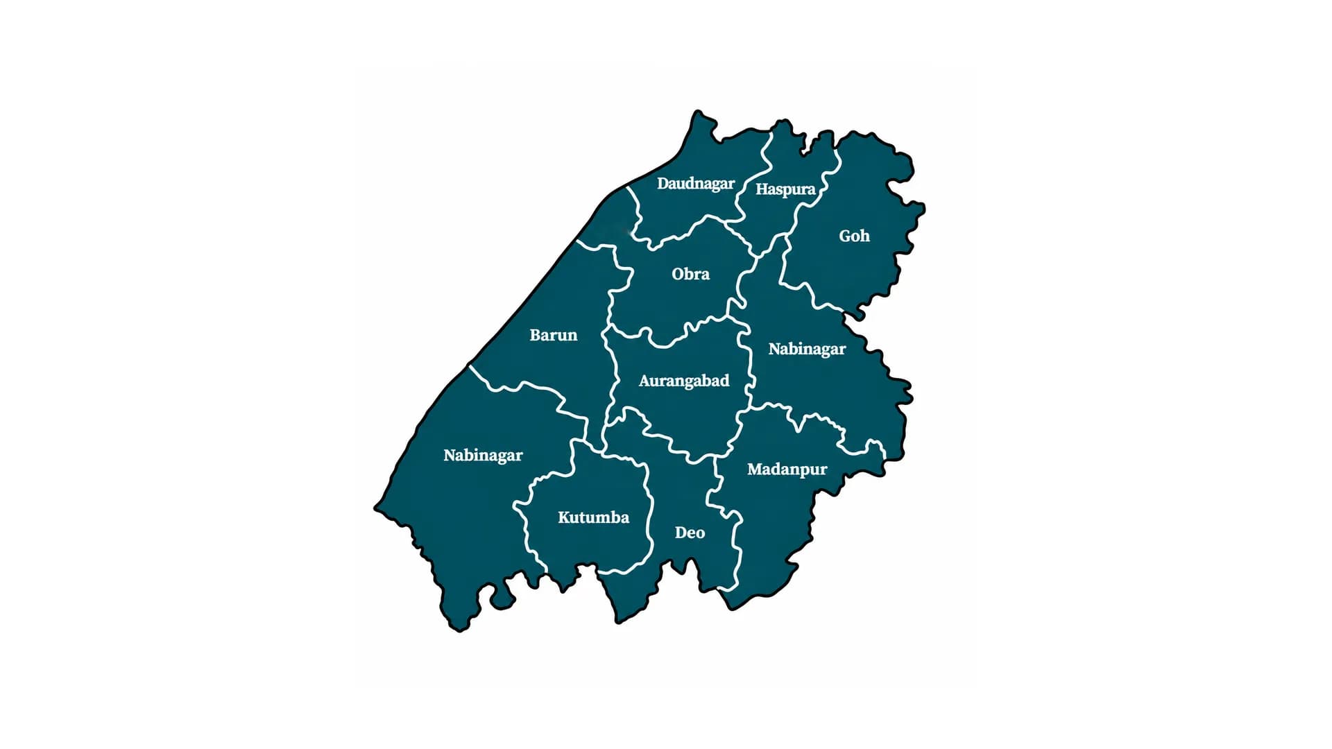
Aurangabad
Aurangabad is a southern Bihar district known for its agricultural economy, historical significance and the famous Deo Sun Temple. It forms part of Magadh Division.
- Headquarters
- Aurangabad
- Division
- Magadh Division
- Established
- 1973
- Area
- 3,305 sq km
- Population
- 2,540,073 (2011)
- Lok Sabha
- Aurangabad, Karakat
- Vidhan Sabha
- Goh | Obra | Nabinagar | Kutumba (SC) | Aurangabad | Rafiganj
Aurangabad District, Bihar
Overview
Aurangabad is an important district in southern Bihar and forms part of Magadh Division. Aurangabad town serves as its administrative headquarters. The district is known for its agricultural economy, historical heritage, religious significance and geographical position near the Bihar-Jharkhand border.
The famous Sun Temple at Deo is one of its most recognised religious landmarks and attracts devotees from different parts of Bihar and neighbouring states.
History and Heritage
Aurangabad has a historical background closely connected with the Magadh region. During the Mughal and British periods, the region was associated with local estates and zamindari administration.
Aurangabad was historically part of the former Bihar district and later functioned as an administrative subdivision. It was established as an independent district on 26 January 1973.
The region also has historical connections with the Indian freedom movement. Local zamindars and communities participated in resistance against British rule.
Geography and Administration
Aurangabad covers approximately 3,305 square kilometres and is part of Magadh Division. It is located in southern Bihar and shares geographical boundaries with Arwal, Gaya, Rohtas and Palamu district of Jharkhand.
The district has two subdivisions: Aurangabad and Daudnagar. It is administratively divided into eleven development blocks.
The Sone River and other local water systems contribute to its agricultural landscape and geographical character.
Population and Demographics
According to the Census of India 2011, Aurangabad district had a population of 2,540,073.
The district recorded a population density of approximately 769 people per square kilometre and a sex ratio of 926 females per 1,000 males. Its literacy rate was approximately 70.32%.
Hindi and Magahi are commonly used across the district. Rural settlements account for a significant share of the population.
Economy and Agriculture
Agriculture is a major contributor to Aurangabad's economy. Paddy, wheat, pulses and other seasonal crops are cultivated in different parts of the district.
The district also has commercial activity linked to local markets, food processing, transportation and small-scale businesses. Its position along important road routes supports trade and movement between Bihar and Jharkhand.
Political Significance
Aurangabad is an important political district of southern Bihar. Its parliamentary representation is distributed across two Lok Sabha constituencies: Aurangabad and Karakat.
The district has six Assembly constituencies: Goh, Obra, Nabinagar, Kutumba (Scheduled Caste), Aurangabad and Rafiganj.
These constituencies represent different parts of the district and participate in elections to the Bihar Legislative Assembly and Lok Sabha.
Culture and Tourism
Aurangabad is particularly known for its religious and cultural heritage. The Deo Sun Temple is one of the most important pilgrimage destinations in the district and is associated with the worship of the Sun God.
Chhath Puja is celebrated with great importance, and devotees visit religious sites and water bodies for traditional rituals.
The district's local fairs, temples and cultural traditions reflect the wider heritage of the Magadh region.
Education and Healthcare
Aurangabad has schools, colleges, technical institutions and other educational facilities serving students from urban and rural areas.
Government hospitals, community health centres and primary healthcare facilities provide medical services to residents. Healthcare and educational infrastructure continue to play an important role in the district's development.
Transport and Connectivity
Aurangabad is connected to other parts of Bihar and neighbouring Jharkhand through road networks. The Grand Trunk Road corridor supports regional transport and commercial activity.
Railway connectivity through nearby stations and road connections to Gaya and other regional centres facilitate passenger and goods transportation.
Development and Urban Growth
Infrastructure expansion, agricultural modernisation, irrigation, education, healthcare and industrial development remain important priorities for Aurangabad.
The district's geographical position and transport links provide opportunities for trade, manufacturing and economic cooperation with neighbouring regions.
Aurangabad District Today
Aurangabad continues to be an important district of southern Bihar because of its agricultural activity, religious heritage and regional connectivity. The Deo Sun Temple remains a major part of its identity, while its administrative and economic activities contribute to the development of Magadh Division.